

We could not have picked a better day to take a nice casual drive to the coast for our annual Spring Fling on April 23. Despite rain the day before, we had blue skies, no wind and mild temperatures.
A large collection of vehicles, dogs and their owners gathered in the Paso Robles Denny’s parking lot at 9AM. Kirk M., our trailboss, explained the plan for the day, which was to head north on Nacimiento Lake Drive/Interlake Road (G14) out of Paso Robles, to Lockwood/Jolon Road and then to Fort Hunter Liggett.
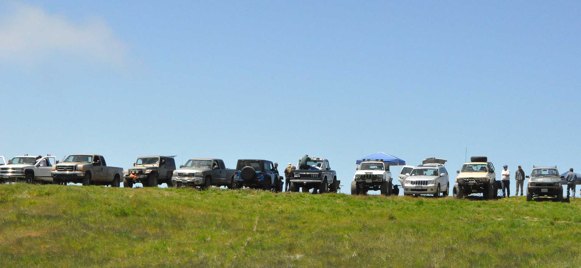
We had a total of 12 rigs:
- Kirk & Ingrid M. and their dog Ione in their 1982 Toyota
- Tom & Karen B. in their 1985 Toyota pickup
- Mike D. in a 1990 Toyota pickup
- Robert & Belen G. in their 2008 Jeep Grand Cherokee
- Jon, Deena and Deegan M. in a 2006 Jeep Rubicon Unlimited
- Casey & Loree M. with their dogs Sissy & RC in their 2000 Ford F350 diesel 7.3L
- Larry & Lyndsee T. with their dogs Moonshine & Rebel in their 1998 Chevy K2500
- Kurt W. and Paul H. in Kurt’s 2014 Jeep Wrangler
- Q, Melia and Araya in their 2014 XTerra
- Laura & Eric H. and Devyn B. in a 2003 GMC Sierra
- A couple whose names I didn’t get in a nicely restored early Bronco
- Terry & Suzy J. in 2011 Jeep JK Rubicon Unlimited
After our travels around the country, it never ceases to amaze me how beautiful this part of California is with its rolling hills, agriculture, wildflowers, soaring hawks, wild turkeys and even herds of elk (yes, I’m pretty sure I saw some near Fort Hunter Liggett).
We stopped at the water crossing at Fort Hunter Liggett and let the dogs and their humans enjoy playing in the water. It was a good time to get acquainted and admire each other’s vehicles.
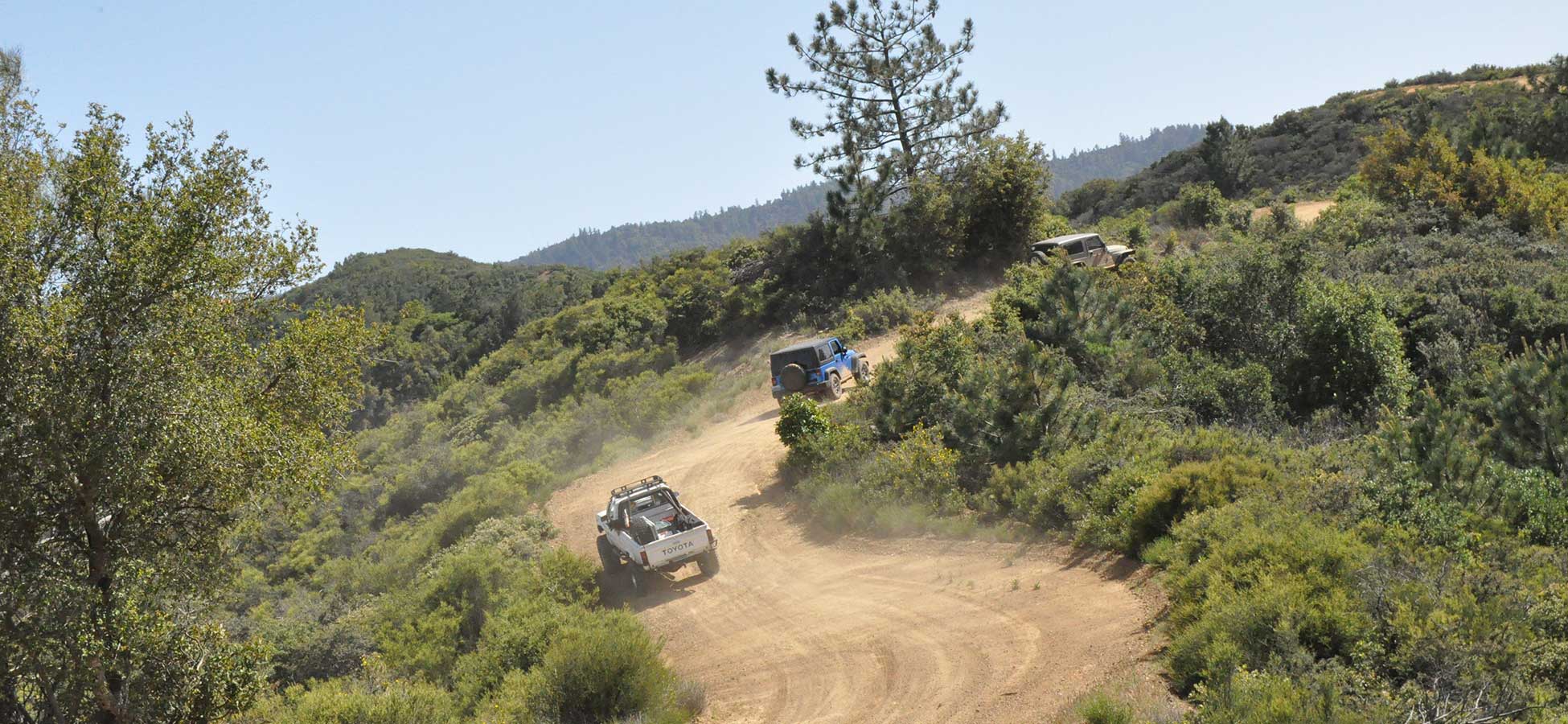
After that we headed out on the winding, slow and scenic Nacimiento-Fergusson Road that would take us to the coast. This road climbs to 2,700 feet, with more than 100 turns on the last part of the road, and offers breathtaking views of the ocean far below.
We became the only ones with mechanical issues on this trip when we got a ‘hot oil’ light on our Jeep. Turns out the transmission overheated a bit due to the long and slow ascent. We should have shifted into first and just left it there instead of letting it hunt for gears.
We left pavement by turning left on the Coast Ridge Trail (Forest Service Rd. #20S05), wound around for a while and then turned on 22S04 onto the Prewitt Ridge area. On the ridge overlooking the Pacific, the group decided that this would be the best spot for lunch. Not only did we have great views, but we also enjoyed watching some very brave souls setting up their hang gliders and para gliders and leaving solid ground on a gust of wind.
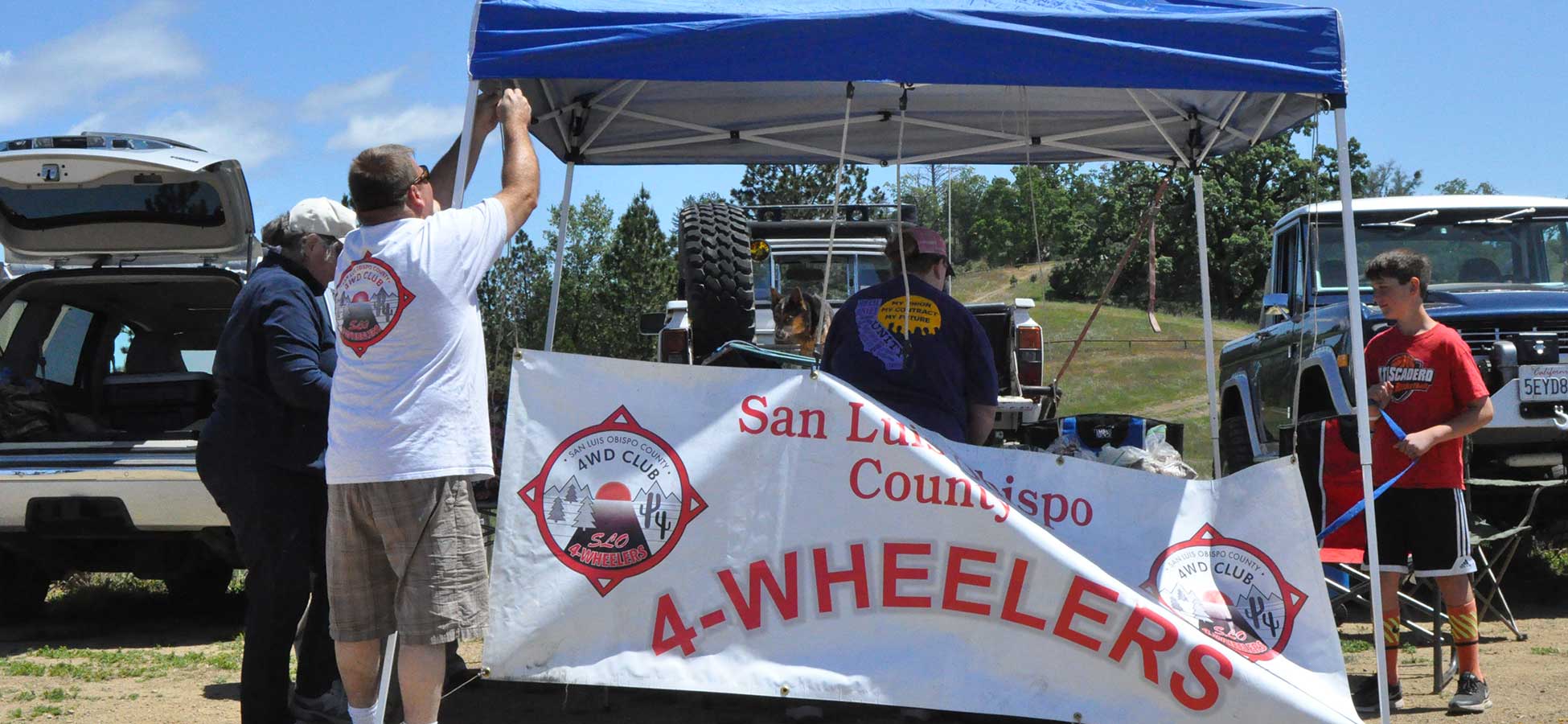
Kirk, Ingrid and others set up the EZ-up, hung up the club banner, and proceeded to put out a delicious spread. We had tri-tip sandwiches, salads and desserts hauled in by our intrepid crew. Just as we were settling into our chairs for a well-deserved meal, a forest service employee showed up and said that we were lawbreakers. It seems that we had parked our rigs just beyond the ‘no parking’ sign (sign, what sign?). We all needed to move forward a few feet to get off of the grass. So the EZ-up sprouted legs, chairs were moved and vehicles inched closer to the para gliders. We managed to avoid getting any parking tickets, and instead were issued free campfire permits.
After at least an hour (maybe two) of eating, chatting and watching the people fly around, we slowly packed up and headed out. I assumed that we were going to go back the way we came, but instead we headed out for more dirt roads. That was fine with me, because there are some great routes back there and I was in no hurry to get back to pavement.
Somehow we got separated from the main group shortly after takeoff, so Terry and I, Tom and Q were left to figure out which way to go. We looked at our vehicle navigation (useless), failed to find a Forest Service map that covered the area, and generally were, well, sort of lost. I pretended to know what I was doing by scouting out the two choices, and decided (wrongly as it turns out), that more vehicles had turned left than had turned right. So we went left in a heading that took us uncomfortably east rather than west. Eventually we were joined by our trailboss, who had doubled back after taking road #23S02, only to find a locked gate.
We continued southeast on the South Coast Ridge Road (#20S05) for about eight miles, enjoying the views while at the same time wondering if we were ever going to come down out of the mountains. Finally, we turned right on #23S01 on Willow Creek and got down to Highway 1.
Goodbyes were said, and I think all of us frantically headed for the nearest restroom. Thank you Kirk and the rest of the crew for a great run and an amazing meal.
Check out all of the photos from the run here: https://www.flickr.com/photos/crazysuzy/albums/72157667380611162
Leave A Comment